
Springfield is called the “Queen City of the Ozarks.” That’s because the city in the southwest corner of Missouri is just a short drive away from the many parks, lakes, and woodlands that are to be found in and around the Ozark Mountains. In addition, the City of Springfield owns and manages more than 60 parks and green spaces. It’s not an understatement to say that Springfield is a hiking paradise. Whether you stay downtown or at one of the Springfield Airport hotels, you’re never far away from a great hiking spot.
Read on for the top seven hiking spots in and around Springfield, Missouri.
Nature Center Trails
Located within the Springfield city limits, near southside Springfield hotels such as the Extended Stay America Springfield South, the Springfield Conservation Nature Center offers a scenic collection of trails, with something for every skill level. The well-maintained trails are open year-round.
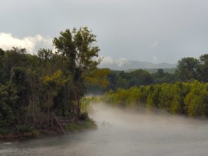
Sac River Trail
Located just northwest of Springfield, the Sac River Trail in Ritter Springs Park is a six-mile loop trail that meanders near the river in and out of the woods. Though open all year, this is a dirt trail and can get rather muddy in the spring.
Wilson’s Creek Mill Trail
Wilson’s Creek was the site of the first major Civil War battle west of the Mississippi River. The site, located north of Springfield near the town of Republic, has been preserved and is now part of the National Park Service. The Wilson’s Creek Mill Trail there is an easy, well-maintained 3.5-mile trail that criss-crosses the creek and bisects the battlefield.
Kings River Overlook
This 1.5-mile trail takes you along the bluffs that line the White River. Located just over the Missouri/Arkansas state line (southwest of Springfield), this moderately difficult trail should take you about one hour to complete and rewards hikers with dramatic views of the Ozark mountains and valleys.
Rock Creek Circle
This 4.2-mile, paved trail provides a scenic trek for hikers with at least moderate experience and stamina. The trail, located southwest of Springfield in the city of Cassville, begins on one side of Rock Creek Canyon, crosses the valley, and climbs back up the other side. The elevation gain is 428 feet. You should allow around two hours to complete the circle.
Frisco Highline Trail
Located northeast of Springfield, near hotels such as the Courtyard by Marriott Springfield Airport, this new trail follows the path of an abandoned railway line. The 7.5-mile, paved trail meanders through the scenic Ozark meadows and woodlands. This is a relatively easy trail with an elevation gain of just 85 feet, and it is open all year round.
The Red Trail at Busiak State Forest
Another favorite Springfield hiking spot is the 2,502-acre Busiak State Forest, located south of Springfield. The park offers 18 miles of year-round hiking trails. Of particular interest is the Red Trail, a 3.1-mile loop that takes about an hour to complete.
What is your favorite place to go hiking around Springfield? Share your thoughts with our readers by leaving a comment below.
Author Bio:
Sandy Mitchell is a full-time freelance writer and former travel agent who writes for Hipmunk among other travel sites. She has traveled extensively throughout the United States and beyond and published two books on Ohio history.